
Presidential Traverse
2016-07-25
Angie and I spent about a month hanging out in the white mountains. I wanted Angie to get above treeline to experience the amazing views. Angie got the idea of doing a presidential traverse... but then she was having trouble with her arch, so she decided she couldn't do it. Well... it sounded like a fun challenge anyway, so Angie dropped me off at the head of Pine Link Trail and went off to hike Washington on her own, while I started my traverse.
Lets start with the photos! Technical details later.
Photos
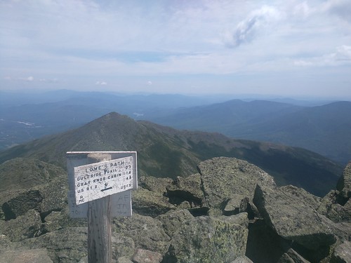
These are in chronological order, looking ot forward and back from each peak. The whole traverse is incredible views, but I thought the photos forward and back from each peak might be illuminating to someone trying to do it. (I left out Washington peak because it's so busy up there I didn't want to hang out to get photos).
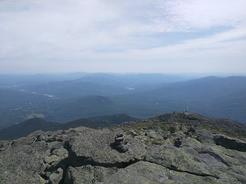
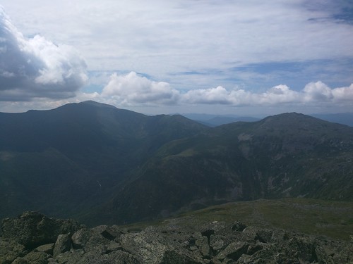
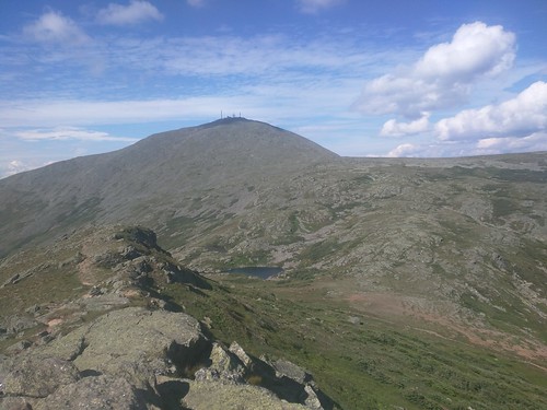
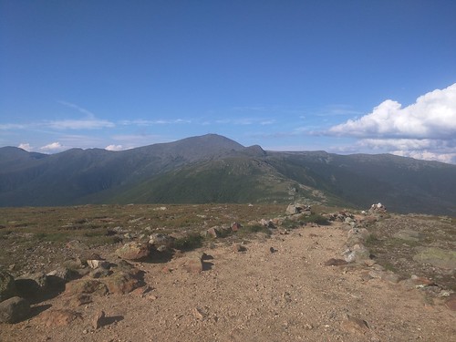
View backwards from Madison.
This shot is looking down Hawker Ridge trail towards pine link trail where I came up. The first hills you can see just behind the mountain I'm standing on is the trail, the cliff in the center of the picture that's part of that ridge is "blueberry cliffs" which is probably a bit over half-way up Madison
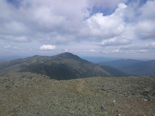
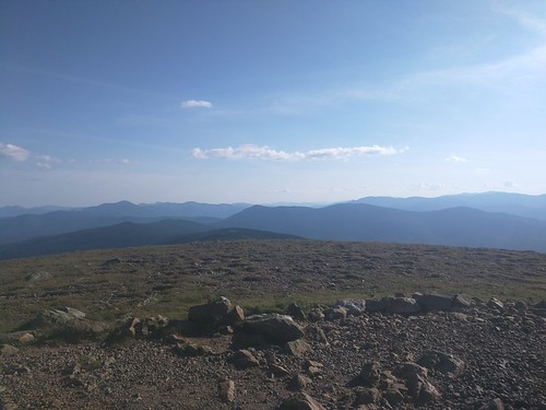
View of Adams and Washington in the background from Madison
View backwards of Madison from Adams
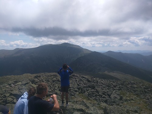
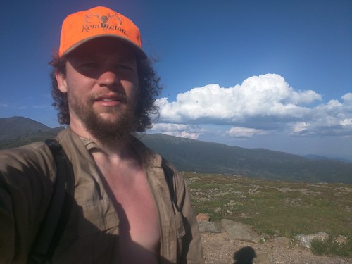
Me, squinting in to the sun on top of Madison... Wondering if I've really got the juice for another 6 peaks
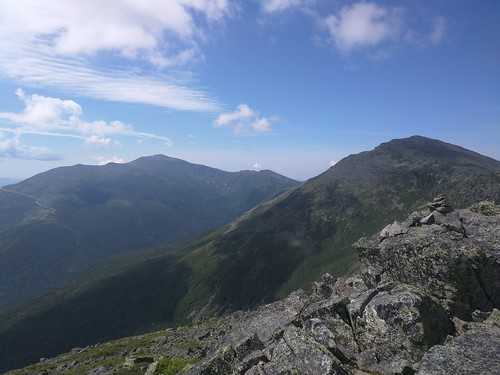
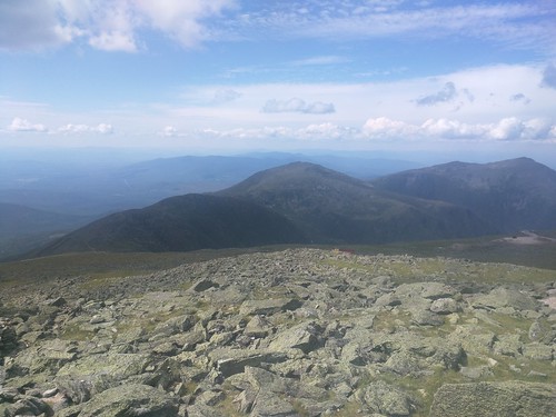
View of Jefferson and Washington from Adams
View of Adams from Jefferson
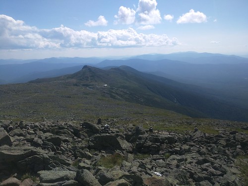
View of Clay (technically a minor summit) and Washington from Jefferson
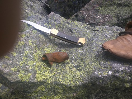
My shoe had a small hole in the toe when I started and it was getting larger, so I decided to patch it up on top of Madison. An S-shaped leather needle and a little linen twine are invaludable for this sort of thing... This patch held for the hike, and a bit more use as well. The string wears out quickly, but It'll hold for 50 to 100 miles, and you can do it about 3 times before the shoe just loses too much structural integrity.
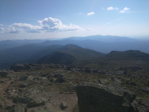
 View of Washington from Clay (technically a minor summit)
View of Clay and Jefferson from Washington
View of Monroe from partway down Washington
View of Washington from Monroe, you can see the lake of the clouds in the middle of the ridge between the two, the hut is hidden from view in this image
View of Eisenhower from Monroe. The run from Monroe to Eisenhower is long knife-edge ridge, absolutely beautiful... and long.
View of Monroe and Washington from Eisenhower
View of Pierce from Eisenhower
I'm starting to get pretty burned by now, I put on my shirt and hat on the way down Washington, but I couldn't stand to button my shirt and my chest just kept burning with the low angle of the sun.
View of Eisenhower from Pierce (a bit below the top actually, there's no view from the top)
There is no real view from Pierce down to Crawford, so I don't have a picture of that.
I got a little sunburned, and a little tired, and had an amazing time.
The Route
A presidential traverse hits all of the mountains named after presidents in the presidential range. Some people do it as a 3 day trip, and some do it as a long one-day day-hike. The trails are very rough, with a lot of clambering over loose talus, so it's hard to do as a 1-day hike... but awesome. The mountains are Madison, Adams, Jefferson, Washington, Monroe, Eisenhower, and Pierce. Interestingly Jackson (past Pierce) isn't named after a president, so isn't required for a "presidential traverse". They say the traverse is 23 miles and 9000 feet of climbing, but that's before you hit every peak on the way (which I did). Peaking adds a little mileage, but a lot more vertical.
Gear
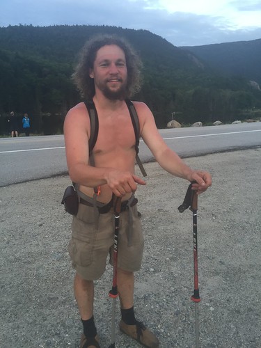
I carried hiking poles, my waxed 5.11 shirt, a sweater, my hunting ball-cap ('cause I'd lost my tilly hat, I have a new one now though), a 40 oz water bottle, some nuts and energy bars, and my normal ditty bag with repair kit, headlamp, iodine, compass, etc.... and of course a map.
Time
We guessed that I'd move at about 3 miles per hour, probably just a touch faster... and thus starting at 8:05 (when I actually walked away from the car... on my second try as I'd forgotten something), going 23'ish miles (maybe a couple more due to peaks) I should finish at about 8:00.
I walked out of the woods on to the street at 8:05... no kidding.
I'm bragging a little, but I want to make sure this is clear to anyone planning to do this hike. The white mountains are very rough terrain, and folks who know the area often will say things like "I generally figure 2 mph for backpacking... except in the whites". I was the fastest person on the trails that day... no-one passed me, and many balked at how fast I flew past them. On the AT I did 4 mph while hiking, 3 mph average for the day, with a backpack. To keep 3mph total average here, with a daypack and no need to hike the next day, I was pushing. The northern end is much much rougher trail than the southern end, so it did get easier, which was nice. Up until Clay or so the rare opportunity to walk at 4 mph on flat or half-jog down a lazy slope was an amazing chance to rest... usually I was clambering over rocks trying not to hurt myself.
Water
I filled up at basically every water crossing I passed, drinking my fill and topping up each time. As a result water was no problem. There was water on the way up Madison, at Madison Hut between Madison and Adams, then a trickle between... I think it was Jefferson and Clay, then a water fountain on Washington, again at lake of the clouds, and there's a spring between Eisenhower and Pierce. I didn't find I needed more on the way down Pierce.
Still, I ran in to some trouble with running out of breath, heat, dehydration and hyponatremia. For running out of breath and heat, I'd slow down just a little... usually not stopping just dropping from maybe 3 to 2.5 mph while rock scrambling up talus... for example. For dehydration I always had enough water, I was just sweating it out, so I was drinking as regularly as I could. For hyponatremia I was carrying a block of Himalayan rock salt that I would suck on occasionally when I felt like I needed it... and of course was eating salty snacks as well.
Ride home
Angie agreed to pick me up in Crawford notch (thanks Angie!), and she even brought Pizza! To synchronize I texted from the top of each mountain, where I was, and the current time. They didn't go through until I was almost to Eisenhower, but at least when she got them she could predict when I'd come out.
Conclusion
Amazingly I actually felt okay the next day. I was sore for sure, but I was only out of commission due to sunburn (my own screwup), and not from the hike. I'm not a hiking pole fanatic, but I love them when I know I'm pushing my abilities, and they were invaluable on this hike. I ended up using them till 2/3'rds of the way up Madison, then stowing them on my pack. Then, when the trail got smooth between Jackson and Clay I pulled them back out, and kept them out for the rest of the hike (there are other sections of talus, but it wasn't worth putting them away again for these shorter sections). This worked perfectly, and my knees weren't sore at all the following day.